
|
| You might also like: | Outline Map: Nigeria | ZOOM SCHOOL Africa | Kenya, Africa | Nigeria | Africa: Ivory Coast Mask Coloring Page | Today's featured page: Structure and Function of the Human Brain |
Africa covers 11,700,000 square miles (30,300,000 square kilometers).
Countries: There are about 53 countries in Africa (some countries are disputed). The biggest country in Africa is Sudan, which covers 967,500 square miles (2,505,816 square kilometers). The countries with the largest populations in Africa are Nigeria (107,000,000 people), Egypt (64,800,000 people), and Ethiopia (58,700,000 people).
Highest and Lowest Points: The tallest point in Africa is Mt. Kilimanjaro, in Tanzania (eastern Africa). Mt. Kilimanjaro is 19,340 feet (5895 meters) tall. Africa has no long mountain chains.
The lowest pont in Africa is Lake Assal, in Djibouti (in eastern Africa near the Horn of Africa); it is 512 feet (156 meters) below sea level.
Lakes: Africa's largest lake is Lake Victoria; it covers 26,836 square miles (69,500 square kilometers). Other large lakes in Africa are Lake Tanganyika, Lake Malawi, and Lake Chad.
Rivers: The longest river in Africa is the Nile River; it is 4,241 miles (6825 kilometers) long. Other long rivers in Africa include the Congo River, the Niger River and the Zambezi River.
Deserts: Africa has many vast deserts, including the largest hot desert in the world, the Sahara. The Sahara Desert is located in northern Africa and covers 3,500,000 square miles (9,065,000 square kilometers). The Kalahari, in southern Africa, is another large desert.
Islands: The biggest island off Africa is Madagascar, which is near the coast of southeast Africa. Madagascar covers 226,658 square miles (587,000 square kilometers). Other islands include the Seychelles (a chain of islands north of Madagascar), the Comoros (another chain of islands north of Madagascar), the Canary Islands (a chain of islands off the northwest coast), the Madeira Islands (another chain of islands off the northwest coast), the Cape Verde Islands (off the coast of western Africa), Equatorial Guinea (off the coast of Cameroon), and Sao Tome (southwest of Equatorial Guinea).
EnchantedLearning.com
African Geography Quiz PrintoutZoomSchool Africa
Africa's Geography
Label African Countries Printout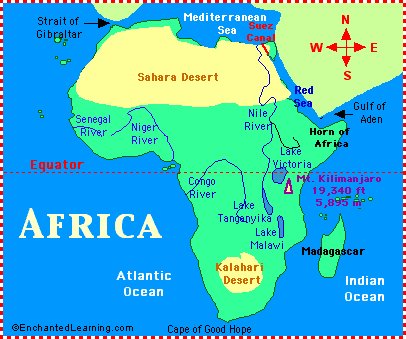 Africa: Africa is the second-largest of the seven continents on Earth (Asia is the largest continent). Africa is bounded by the Atlantic Ocean on the west, the Indian Ocean on the east, the Mediterranean Sea on the north, and the Red Sea on the northeast.
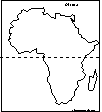 Africa: Outline Map Printout An outline map of Africa to print. |
 Africa: Label Me! Printout with First Letter Hints Label the countries and bodies of water of Africa, given the first letter of the places. Answers |
African Countries: Label Me! Printout Label the countries of Africa. Answers |
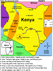
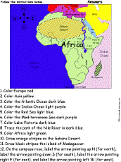 Africa: Follow the Instructions Color Africa according to simple directions, such as, "Trace the path of the Nile River in dark blue." Or go to the answers. |
 African Countries: A Coloring Book To Print Print a coloring book of African countries. When you're done, locate the countries on a map of Africa, then label and color them. |
 African Countries: Outline Map Printout An outline map of African countries to print. |
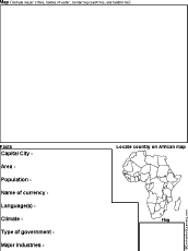 Africa Country Report Graphic Organizer Printout #1 This printout helps the student do a short report on an African country, prompting the student to draw a map of the country, locate it on a map of Africa, draw the country's flag, and write the country's continent, capital city, area, population, name of currency, and language(s). |
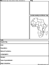 Africa Country Report Graphic Organizer Printout #2 This printout helps the student do a short report on an African country, prompting the student to draw a map of the country, locate it on a map of Africa, draw the country's flag, and write the country's continent, capital city, area, population, name of currency, language(s), climate, type of government, and major industries. |
Africa: Shape Poem  Write a poem about Africa inside the map. Or go to a pdf of the poem worksheet. |
Africa: Perimeter Poem  Write a poem around the perimeter (outer edges) of the map of Africa. Or go to a pdf of the poem worksheet. |
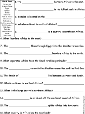 Africa Quiz A Worksheet to Print A short, printable worksheet quiz about Africa. The short-answer worksheet asks general questions about Africa, for example, "What is the large desert in northern Africa? ______." Select the answers from a word bank. Or go to the answers. |
 African Rivers Labeled: Outline Map Printout A labeled outline map of Africa's major rivers to print. |
 African Rivers: Outline Map Printout An outline map of Africa's major rivers to print. |
Africa: Zoom School Use a pictorial interface to get information on Africa. including maps, quizzes, animals, explorers, and printouts on Africa. |
 Explorers of Africa |
 Flags of Africa |
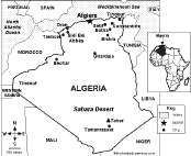
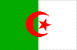 All About Algeria Information on Algeria, a country in northern Africa. Do worksheets on the map and the flag of Algeria. |
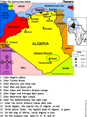 Algeria: Follow the Instructions Color Algeria according to simple directions, such as, "Circle Algiers, the capital city of Algeria, in red." Or go to the answers. |
 Algeria: Outline Map Printout An outline map of Algeria to print. Or go to printable activities that require research (using an atlas or other geography reference): a simple map research activity, a medium-level map research activity, or an advanced map research activity. |
 Algeria: Map Quiz Worksheet A printable quiz on the major geographic features of Algeria. The student reads a map to answer 10 geography questions. Or go to the answers. |
 Algeria: Dot to Dot Mystery Map Connect the dots to draw the borders of a mystery country. Then use a globe or atlas to figure out which country you have drawn. You might want to give students clues, such as the continent the country is in (Africa), that it is in the Northern Hemisphere, or that its name starts with "A." Answer: Algeria. |
 Angola: Outline Map Printout An outline map of Angola to print. Or go to printable worksheets that require research (using an atlas or other geography reference): a simple map research activity, a medium-level map research activity, or an advanced map research activity. |
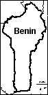 Benin: Outline Map Printout An outline map of Benin to print. Or go to printable worksheets that require research (using an atlas or other geography reference): a simple map research activity, a medium-level map research activity, or an advanced map research activity. |
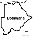 Botswana: Outline Map Printout An outline map of Botswana to print. Or go to printable activities that require research (using an atlas or other geography reference): a simple map research activity, a medium-level map research activity, or an advanced map research activity. |
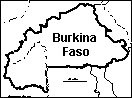 Burkina Faso: Outline Map Printout An outline map of Burkina Faso to print. Or go to printable worksheets that require research (using an atlas or other geography reference): a simple map research activity, a medium-level map research activity, or an advanced map research activity. |
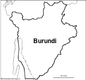 Burundi: Outline Map Printout An outline map of Burundi to print. Or go to printable worksheets that require research (using an atlas or other geography reference): a simple map research activity, a medium-level map research activity, or an advanced map research activity. |
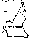 Cameroon: Outline Map Printout An outline map of Cameroon to print. Or go to printable worksheets that require research (using an atlas or other geography reference): a simple map research activity, a medium-level map research activity, or an advanced map research activity. |
 Central African Republic Outline Map An outline map of the Central African Republic to print. |
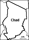 Chad: Outline Map Printout An outline map of Chad to print. Or go to printable activities that require research (using an atlas or other geography reference): a simple map research activity, a medium-level map research activity, or an advanced map research activity. |
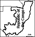 Congo, Republic of the An outline map of the Republic of the Congo to print. |
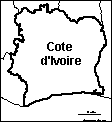 Cote d'Ivoire: Outline Map Printout An outline map of Cote d'Ivoire to print. Or go to printable activities that require research (using an atlas or other geography reference): a simple map research activity, a medium-level map research activity, or an advanced map research activity. |
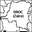 Democratic Republic of the Congo (formerly Zaire) Outline Map An outline map of DROC to print. Or go to printable activities that require research (using an atlas or other geography reference): a simple map research activity, a medium-level map research activity, or an advanced map research activity. |
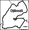 Djibouti: Outline Map Printout An outline map of Djibouti to print. Or go to printable activities that require research (using an atlas or other geography reference): a simple map research activity, a medium-level map research activity, or an advanced map research activity. |
 Egypt Information and activities on Egypt to print. |
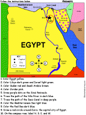 Egypt: Follow the Instructions Color Egypt according to simple directions, such as, "Trace the path of the Nile River in blue." Or go to the answers. |
 Egypt: Dot to Dot Mystery Map Connect the dots to draw the borders of a mystery country. Then use a globe or atlas to figure out which country you have drawn. You might want to give students clues, such as the continent the country is in (Africa), that it is in the Northern Hemisphere, or that its name starts with "E." Answer: Egypt. |
 Egypt: Map Quiz Worksheet A printable quiz on the major geographic features of Egypt. The student reads a map to answer 10 geography questions. Or go to the answers. |
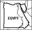
 Egypt: Label Me! Printout Label a map of Egypt. Answers |
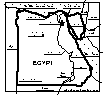
 Egypt: Outline Map Printout An outline map of Egypt to print. Or go to printable activities that require research (using an atlas or other geography reference): a simple map research activity, a medium-level map research activity, or an advanced map research activity. |
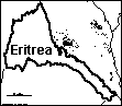 Eritrea An outline map of Eritrea to print. Or go to printable worksheets that require research (using an atlas or other geography reference): a simple map research activity, a medium-level map research activity, or an advanced map research activity. |
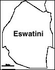 Eswatini: Outline Map Printout An outline map of Eswatini to print. Or go to printable worksheets that require research (using an atlas or other geography reference): a simple map research activity, a medium-level map research activity, or an advanced map research activity. |
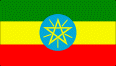
All About Ethiopia Information on Ethiopia, a landlocked country in eastern Africa. Do worksheets on the map and the flag of Ethiopia. |
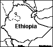 Ethiopia: Outline Map Printout An outline map of Ethiopia to print. Or go to printable worksheets that require research (using an atlas or other geography reference): a simple map research activity, a medium-level map research activity, or an advanced map research activity. |
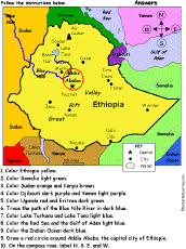 Ethiopia: Follow the Instructions Color Ethiopia according to simple directions, such as, "Trace the path of the Blue Nile River in dark blue." Or go to the answers. |
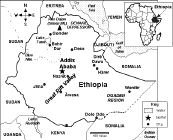 Ethiopia: Map Quiz Worksheet A printable quiz on the major geographic features of Ethiopia. The student reads a map to answer 10 geography questions. Or go to the answers. |
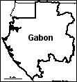 Gabon: Outline Map Printout An outline map of Gabon to print. Or go to printable worksheets that require research (using an atlas or other geography reference): a simple map research activity, a medium-level map research activity, or an advanced map research activity. |
 Gambia, The: Outline Map Printout An outline map of Gambia to print. |
 Ghana: Outline Map Printout An outline map of Ghana to print. Or go to printable worksheets that require research (using an atlas or other geography reference): a simple map research activity, a medium-level map research activity, or an advanced map research activity. |
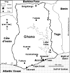 Ghana: Map Quiz Worksheet A printable quiz on the major geographic features of Ghana. The student reads a map to answer 10 geography questions. Or go to the answers. |
 Guinea: Outline Map Printout An outline map of Guinea to print. |
Ivory Coast: Outline Map Printout An outline map of the Ivory Coast to print. |
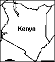 Kenya: Outline Map Printout An outline map of Kenya to print. Or go to printable worksheets that require research (using an atlas or other geography reference): a simple map research activity, a medium-level map research activity, or an advanced map research activity. |
 Kenya: Dot to Dot Mystery Map Connect the dots to draw the borders of a mystery country. Then use a globe or atlas to figure out which country you have drawn. You might want to give students clues, such as the continent the country is in (Africa), that it straddles the Equator, or that its name starts with "K." Answer: Kenya. |
 Kenya: Follow the Instructions Draw and color Kenya according to simple directions, such as, "Draw a red circle around Nairobi, the capital city of Kenya." Or go to the answers. |
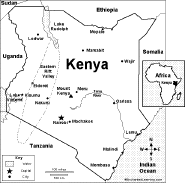 Kenya: Map Quiz Worksheet A printable quiz on the major geographic features of Kenya. The student reads a map to answer 10 geography questions. Or go to the answers. |
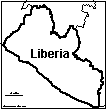 Liberia: Outline Map Printout An outline map of Liberia to print. Or go to printable worksheets that require research (using an atlas or other geography reference): a simple map research activity, a medium-level map research activity, or an advanced map research activity. |
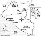 Liberia: Map Quiz Worksheet A printable quiz on the major geographic features of Liberia. The student reads a map to answer 10 geography questions. Or go to the answers. |
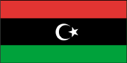 All About Libya Information on Libya, a country in northern Africa. Do worksheets on the map and the flag of Libya. |
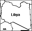 Libya: Outline Map Printout An outline map of Libya to print. Or go to printable worksheets that require research (using an atlas or other geography reference): a simple map research activity, a medium-level map research activity, or an advanced map research activity. |
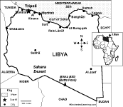 Libya: Map Quiz Worksheet A printable quiz on the major geographic features of Libya. The student reads a map to answer 10 geography questions. Or go to the answers. |
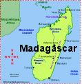 Madagascar An page on the geography, people, and wildlife of Madagascar with an accompanying quiz. |
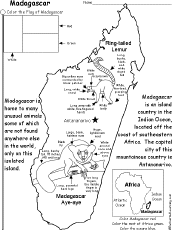 Madagascar: Coloring Printout An easy, printable coloring worksheet about Madagascar with a map of Madagascar, its flag, and labeled pictures of the lemur and aye-aye. |
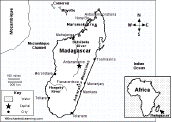 Madagascar: Map Quiz Worksheet A printable quiz on the major geographic features of Madagascar. The student reads a map to answer 10 geography questions. Or go to the answers. |
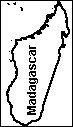 Madagascar: Outline Map Printout An outline map of Madagascar to print. Or go to printable worksheets that require research (using an atlas or other geography reference): a simple map research activity, a medium-level map research activity, or an advanced map research activity. |
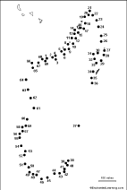 Madagascar: Dot to Dot Mystery Map Connect the dots to draw the borders of a mystery country. Then use a globe or atlas to figure out which country you have drawn. You might want to give students clues, such as the continent the country is in (Africa), that it is in the Southern Hemisphere, or that its name starts with "M." Answer: Madagascar. |
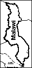 Malawi: Outline Map Printout An outline map of Malawi to print. Or go to printable worksheets that require research (using an atlas or other geography reference): a simple map research activity, a medium-level map research activity, or an advanced map research activity. |
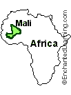 Mali Mali is an inland country in western Africa. Timbuktu is an ancient city in Mali. |
 Mali: Dot to Dot Mystery Map Connect the dots to draw the borders of a mystery country. Then use a globe or atlas to figure out which country you have drawn. You might want to give students clues, such as the continent the country is in (Africa), that it is in the Northern Hemisphere, or that its name starts with "M." Answer: Mali. |
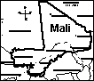 Mali: Label Me! Printout Label a map of Mali. Answers |
 Mali: Outline Map Printout An outline map of Mali to print. Or go to printable worksheets that require research (using an atlas or other geography reference): a simple map research activity, a medium-level map research activity, or an advanced map research activity. |
Mali: Dot to Dot Mystery Map Connect the dots to draw the borders of a mystery country. Then use a globe or atlas to figure out which country you have drawn. You might want to give students clues, such as the continent the country is in (Africa), that it is an island, or that its name starts with "M." Answer: Mali. |
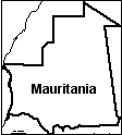 Mauritania: Outline Map Printout An outline map of Mauritania to print. Or go to printable worksheets that require research (using an atlas or other geography reference): a simple map research activity, a medium-level map research activity, or an advanced map research activity. |
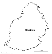 Mauritius: Outline Map Printout An outline map of Mauritius to print. |
 Mediterranean Outline Map Printout An outline map of the Mediterranean Sea to print. |
 Morocco An outline map of Morocco to print. Or go to printable activities that require research (using an atlas or other geography reference): a simple map research activity, a medium-level map research activity, or an advanced map research activity. |
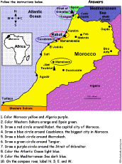 Morocco: Follow the Instructions Draw and color Morocco according to simple directions, such as, "Draw a blue circle around Casablanca, the biggest city in Morocco." Or go to the answers. |
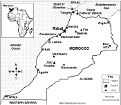 Morocco: Map Quiz Worksheet A printable quiz on the major geographic features of Morocco. The student reads a map to answer 10 geography questions. Or go to the answers. |
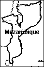 Mozambique An outline map of Mozambique to print. Or go to printable worksheets that require research (using an atlas or other geography reference): a simple map research activity, a medium-level map research activity, or an advanced map research activity. |
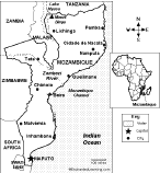 Mozambique: Map Quiz Worksheet A printable quiz on the major geographic features of Mozambique. The student reads a map to answer 10 geography questions. Or go to the answers. |
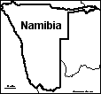 Namibia: Outline Map Printout An outline map of Namibia to print. Or go to printable worksheets that require research (using an atlas or other geography reference): a simple map research activity, a medium-level map research activity, or an advanced map research activity. |
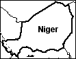 Niger: Outline Map Printout An outline map of Niger to print. Or go to printable worksheets that require research (using an atlas or other geography reference): a simple map research activity, a medium-level map research activity, or an advanced map research activity. |
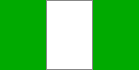 All About Nigeria Information on Nigeria, a country in western Africa. Do worksheets on the map and the flag of Nigeria. |
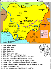 Nigeria: Follow the Instructions Color Nigeria according to simple directions, such as, "Color Pakistan yellow." Or go to the answers. |
 Nigeria An outline map of Nigeria to print. Or go to printable worksheets that require research (using an atlas or other geography reference): a simple map research activity, a medium-level map research activity, or an advanced map research activity. |
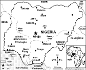 Nigeria: Map Quiz Worksheet A printable quiz on the major geographic features of Nigeria. The student reads a map to answer 10 geography questions. Or go to the answers. |
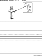 Picture Prompt - Africa Write a story about the picture showing a child pointing to a map of Africa - for young writers. |
Republic of the Congo An outline map of the Republic of the Congo to print. |
 Rwanda An outline map of Rwanda to print. Or go to printable worksheets that require research (using an atlas or other geography reference): a simple map research activity, a medium-level map research activity, or an advanced map research activity. |
 Senegal: Outline Map Printout An outline map of Senegal to print. Or go to printable worksheets that require research (using an atlas or other geography reference): a simple map research activity, a medium-level map research activity, or an advanced map research activity. |
 Sierra Leone: Outline Map Printout An outline map of Sierra Leone to print. Or go to printable worksheets that require research (using an atlas or other geography reference): a simple map research activity, a medium-level map research activity, or an advanced map research activity. |
 All About Somalia Information on Somalia, a country on the horn of Africa. Do worksheets on the map and the flag of Somalia. |
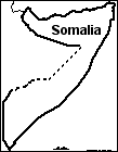 Somalia: Outline Map Printout An outline map of Somalia to print. Or go to printable worksheets that require research (using an atlas or other geography reference): a simple map research activity, a medium-level map research activity, or an advanced map research activity. |
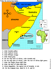 Somalia: Follow the Instructions Draw and color Somalia according to simple directions, such as, "Draw a red circle around Mogadishu, the capital city of Somalia." Or go to the answers. |
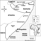 Somalia: Map Quiz Worksheet A printable quiz on the major geographic features of Somalia. The student reads a map to answer 10 geography questions. Or go to the answers. |
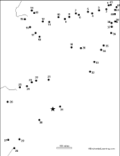 Somalia: Dot to Dot Mystery Map Connect the dots to draw the borders of a mystery country. Then use a globe or atlas to figure out which country you have drawn. You might want to give students clues, such as the continent the country is in (Africa), that it is located in the Horn of Africa, or that its name starts with "S." Answer: Somalia. |
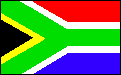 All About South Africa Information on South Africa, a country at the southern tip of Africa. Do worksheets on the map and the flag of South Africa. |
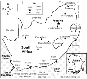 South Africa: Map Quiz Worksheet A printable quiz on the major geographic features of South Africa. The student reads a map to answer 10 geography questions. Or go to the answers. |
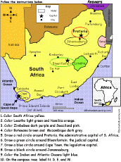 South Africa: Follow the Instructions Draw and color South Africa according to simple directions, such as, "Draw a red circle around Pretoria, the administrative capital city of South Africa." Or go to the answers. |
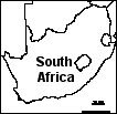 South Africa: Outline Map Printout An outline map of South Africa to print. Or go to printable worksheets that require research (using an atlas or other geography reference): a simple map research activity, a medium-level map research activity, or an advanced map research activity. |
 South Africa: Dot to Dot Mystery Map Connect the dots to draw the borders of a mystery country. Then use a globe or atlas to figure out which country you have drawn. You might want to give students clues, such as the continent the country is in (Africa), that it is in the Southern Hemisphere, or that its name starts with "S." Answer: South Africa. |
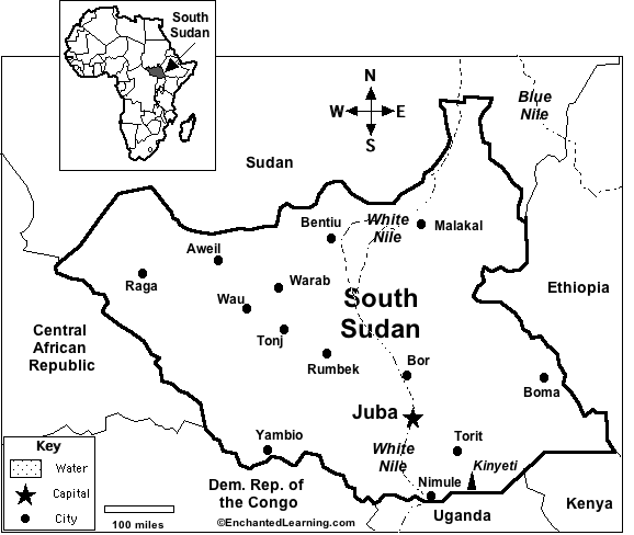 South Sudan Learn basic facts about South Sudan. |
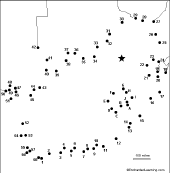
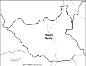 South Sudan An outline map of South Sudan to print. Or go to printable worksheets that require research (using an atlas or other geography reference): a simple map research activity, a medium-level map research activity, or an advanced map research activity. |
 South Sudan: Map Quiz Worksheet A printable quiz on the major geographic features of South Sudan. The student reads a map to answer 10 geography questions, for example: "If you traveled south from Juba, which country would you enter?" Or go to the answers. Or go to a pdf of the quiz and the answers |
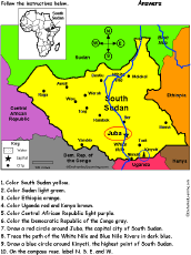 South Sudan: Follow the Instructions Draw and color South Sudan according to simple directions, such as, "Draw a red circle around Juba, the capital city of Sudan." Or go to the answers. |
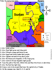 Sudan: Follow the Instructions Draw and color Sudan according to simple directions, such as, "Draw a red circle around Khartoum, the capital city of Sudan." Or go to the answers. |
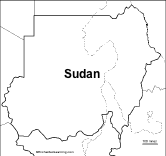 Sudan An outline map of Sudan to print. Or go to printable worksheets that require research (using an atlas or other geography reference): a simple map research activity, a medium-level map research activity, or an advanced map research activity. |
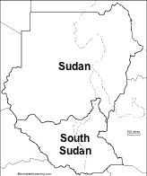 Sudan and South Sudan An outline map of Sudan and South Sudan to print. |
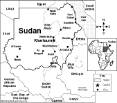 Sudan: Map Quiz Worksheet A printable quiz on the major geographic features of Sudan. The student reads a map to answer 10 geography questions, for example: "If you traveled south from Khartoum, which country would you enter?" Or go to the answers. Or go to a pdf of the quiz and the answers |
 Sudan: Dot to Dot Mystery Map Connect the dots to draw the borders of a mystery country. Then use a globe or atlas to figure out which country you have drawn. You might want to give students clues, such as the continent the country is in (Africa), that it is in the Northern Hemisphere, or that its name starts with an "S." Answer: Sudan. |
Swaziland (now Eswatini): Outline Map Printout An outline map of Eswatini to print. Or go to printable worksheets that require research (using an atlas or other geography reference): a simple map research activity, a medium-level map research activity, or an advanced map research activity. |
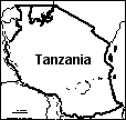 Tanzania An outline map of Tanzania to print. Or go to printable worksheets that require research (using an atlas or other geography reference): a simple map research activity, a medium-level map research activity, or an advanced map research activity. |
The Gambia: Outline Map Printout An outline map of The Gambia to print. |
 All About Tunisia Information on Tunisia, a country in northern Africa. Do worksheets on the map and the flag of Tunisia. |
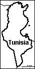 Tunisia An outline map of Tunisia to print. Or go to printable worksheets that require research (using an atlas or other geography reference): a simple map research activity, a medium-level map research activity, or an advanced map research activity. |
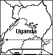 Uganda An outline map of Uganda to print. Or go to printable worksheets that require research (using an atlas or other geography reference): a simple map research activity, a medium-level map research activity, or an advanced map research activity. |
 Uganda: Map Quiz Worksheet A printable quiz on the major geographic features of Uganda. The student reads a map to answer 10 geography questions. Or go to the answers. |
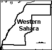 Western Sahara An outline map of Western Sahara to print. |
 Western Sahara: Dot to Dot Mystery Map Connect the dots to draw the borders of a mystery country. Then use a globe or atlas to figure out which country you have drawn. You might want to give students clues, such as the continent the country is in (Africa), that it is in the Northern Hemisphere, or that its name starts with "W." Answer: Western Sahara. |
 Zambia An outline map of Zambia to print. |
 Zimbabwe An outline map of Zimbabwe to print. |
Related Pages:
 STRING OF AFRICAN FLAGS Make a string of African flags from construction paper and yarn or string. When you're done, locate the countries on a map of Africa. |
 African Spelling Word Questions Use the list of words to answer simple questions about words related to Africa. Words: Africa, continent, equator, Sahara, Victoria, Cape, Nile, South, Egypt, Sudan, countries, Madagascar. Or go to the answers. |
|
Related Pages -- African Animals:
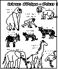
African Animals Printouts of many African animals.Africa is the second-largest continent and has many varied environments. |
 African Animals: Label Me! Label ten African animals. Answers |
 African Animals in French Printout Many African animals in French. |
 African Animals in Spanish Printout Many African animals in Spanish. |
Enchanted Learning®
Over 35,000 Web Pages
Sample Pages for Prospective Subscribers, or click below
|
Overview of Site What's New Enchanted Learning Home Monthly Activity Calendar Books to Print Site Index K-3 Crafts K-3 Themes Little Explorers Picture dictionary PreK/K Activities Rebus Rhymes Stories Writing Cloze Activities Essay Topics Newspaper Writing Activities Parts of Speech Fiction The Test of Time
|
Biology Animal Printouts Biology Label Printouts Biomes Birds Butterflies Dinosaurs Food Chain Human Anatomy Mammals Plants Rainforests Sharks Whales Physical Sciences: K-12 Astronomy The Earth Geology Hurricanes Landforms Oceans Tsunami Volcano |
Languages Dutch French German Italian Japanese (Romaji) Portuguese Spanish Swedish Geography/History Explorers Flags Geography Inventors US History Other Topics Art and Artists Calendars College Finder Crafts Graphic Organizers Label Me! Printouts Math Music Word Wheels |
Click to read our Privacy Policy
| Search the Enchanted Learning website for: |