|
| You might also like: | Q: GEOGRAPHY | Y: GEOGRAPHY | Outline Map Scotland | R: GEOGRAPHY | D: GEOGRAPHY | Today's featured page: The Gingerbread Man |
| Our subscribers' grade-level estimate for this page: 4th - 5th |
 Outline Maps |
EnchantedLearning.com World Geography |
 Flags |
| Africa | Antarctica | Asia | Australia/Oceania | Central America/ Caribbean | Europe | Mideast | North America | South America | USA |
| A | B | C | D | E | F | G | H | I | J | K | L | M | N | O | P | Q | R | S | T | U | V | W | X | Y | Z |
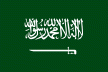 All About Saudi Arabia Information on Saudi Arabia, a country in Southwestern Asia (in the Middle East). Do worksheets on the map and the flag of Saudi Arabia. |
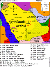 Saudi Arabia: Follow the Instructions Draw and color Saudi Arabia according to simple directions, such as, "Color the Persian Gulf light blue." Or go to the answers. |
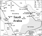 Saudi Arabia: Map Quiz Worksheet A printable quiz on the major geographic features of Saudi Arabia. The student reads a map to answer 10 geography questions. Or go to the answers. |
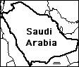 Saudi Arabia: Outline Map Printout An outline map of Saudi Arabia to print. Or go to printable activities that require research (using an atlas or other geography reference): a simple map research activity, a medium-level map research activity, or an advanced map research activity. |
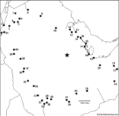 Saudi Arabia: Dot to Dot Mystery Map Connect the dots to draw the borders of a mystery country. Then use a globe or atlas to figure out which country you have drawn. You might want to give students clues, such as the continent the country is in (Asia), that it is in the Middle East, that it is in the Northern Hemisphere, or that its name starts with "S." Answer: Saudi Arabia. |
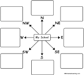 My School: Compass Rose Map In this printable map activity, the student has to think about where things are located with respect to a familiar place. For each direction in the compass rose (N, NE, E, SE, S, SW, W, NW), write something that is located in that direction from your school. |
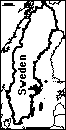
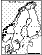 Scandinavia: Outline Map Printout An outline map of Norway, Sweden, Denmark, and Finland to print. |
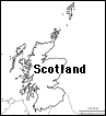 Scotland: Outline Map Printout An outline map of Scotland to print. |
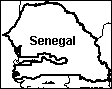 Senegal: Outline Map Printout An outline map of Senegal to print. Or go to printable worksheets that require research (using an atlas or other geography reference): a simple map research activity, a medium-level map research activity, or an advanced map research activity. |
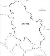 Serbia: Outline Map Printout An outline map of Serbia to print. |
 Serbia and Montenegro: Outline Map Printout An outline map of Serbia and Montenegro (formerly Yugoslavia) to print. Or go to printable worksheets that require research (using an atlas or other geography reference): a simple map research activity, a medium-level map research activity, or an advanced map research activity. |
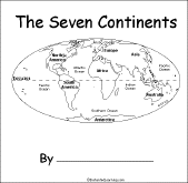 The Seven Continents A short activity book on the continents to print for early readers. There are pages on each of the seven continents. |
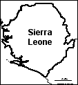 Sierra Leone: Outline Map Printout An outline map of Sierra Leone to print. Or go to printable worksheets that require research (using an atlas or other geography reference): a simple map research activity, a medium-level map research activity, or an advanced map research activity. |
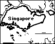 Singapore: Outline Map Printout An outline map of Singapore to print. |
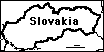 Slovakia: Outline Map Printout An outline map of Slovakia to print. |
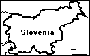 Slovenia: Outline Map Printout An outline map of Slovenia to print. |
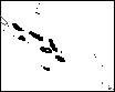 Solomon Islands: Outline Map Printout An outline map of the Solomon Islands to print. |
 All About Somalia Information on Somalia, a country on the horn of Africa. Do worksheets on the map and the flag of Somalia. |
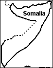 Somalia: Outline Map Printout An outline map of Somalia to print. Or go to printable worksheets that require research (using an atlas or other geography reference): a simple map research activity, a medium-level map research activity, or an advanced map research activity. |
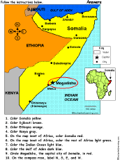 Somalia: Follow the Instructions Draw and color Somalia according to simple directions, such as, "Draw a red circle around Mogadishu, the capital city of Somalia." Or go to the answers. |
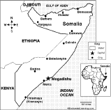 Somalia: Map Quiz Worksheet A printable quiz on the major geographic features of Somalia. The student reads a map to answer 10 geography questions. Or go to the answers. |
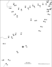 Somalia: Dot to Dot Mystery Map Connect the dots to draw the borders of a mystery country. Then use a globe or atlas to figure out which country you have drawn. You might want to give students clues, such as the continent the country is in (Africa), that it is located in the Horn of Africa, or that its name starts with "S." Answer: Somalia. |
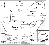
 All About South Africa Information on South Africa, a country at the southern tip of Africa. Do worksheets on the map and the flag of South Africa. |
 South Africa: Map Quiz Worksheet A printable quiz on the major geographic features of South Africa. The student reads a map to answer 10 geography questions. Or go to the answers. |
 South Africa: Outline Map Printout An outline map of South Africa to print. Or go to printable worksheets that require research (using an atlas or other geography reference): a simple map research activity, a medium-level map research activity, or an advanced map research activity. |
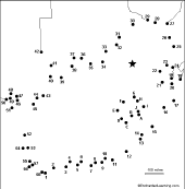 South Africa: Dot to Dot Mystery Map Connect the dots to draw the borders of a mystery country. Then use a globe or atlas to figure out which country you have drawn. You might want to give students clues, such as the continent the country is in (Africa), that it is in the Southern Hemisphere, or that its name starts with "S." Answer: South Africa. |
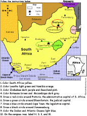 South Africa: Follow the Instructions Draw and color South Africa according to simple directions, such as, "Draw a red circle around Pretoria, the administrative capital city of South Africa." Or go to the answers. |
 South America (Flags) |
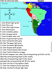 South America: Follow the Instructions Draw and color South America according to simple directions, such as, "Color Peru red." Or go to the answers. |
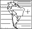
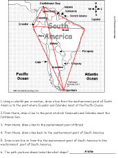 South America: Follow the Instructions #2 Draw lines on the map of South America according to simple directions, such as, "Draw a line back to the easternmost point of Brazil." Or go to the answers. |
 South America: Map Quiz Printout Take a quiz on the map of South America. Or go to the answers. |
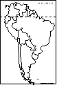 South America: Outline Map Printout An outline map of South America (with country markings) to print. |
 South America (no country markings): Outline Map Printout An outline map of South America (with no country markings) to print. |
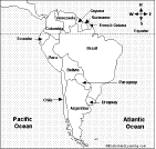
 South American Countries: Label Me! Printout Label the countries of South America. Answers |
 South American Country Report Graphic Organizer Printout #1 This printout helps the student do a short report on a South American country, prompting the student to draw a map of the country, locate it on a map of South America, draw the country's flag, and write the country's continent, capital city, area, population, name of currency, and language(s). |
 South American Country Report Graphic Organizer Printout #2 This printout helps the student do a short report on a South American country, prompting the student to draw a map of the country, locate it on a map of South America, draw the country's flag, and write the country's continent, capital city, area, population, name of currency, language(s), climate, type of government, and major industries. |
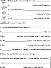 South America Quiz A Worksheet to Print A short, printable worksheet quiz about South America. The short-answer worksheet asks 15 general questions about South America, for example, "The largest country in South America is ______." Select the answers from a word bank. Or go to the answers. |
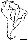 South American Rivers: Outline Map Printout An outline map of the major rivers of South America to print. |
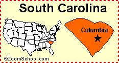 South Carolina South Carolina is a state in the eastern United States of America. Its capital is Columbia. Map, flag, symbols, printouts, and quizzes. |
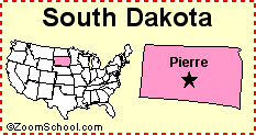 South Dakota South Dakota is a state in the United States of America. Its capital is Pierre. Map, flag, symbols, printouts, and quizzes. |
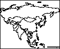
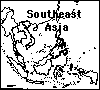 Southeast Asia: Outline Map Printout An outline map of Southeast Asia to print. |
 South Korea: Label Me! Printout Label the map of South Korea. Answers |
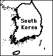 South Korea: Outline Map Printout An outline map of South Korea to print. Or go to printable activities that require research (using an atlas or other geography reference): a simple map research activity, a medium-level map research activity, or an advanced map research activity. |
 South Pole The south pole is the southern-most point on the Earth; it is located on the continent of Antarctica. |
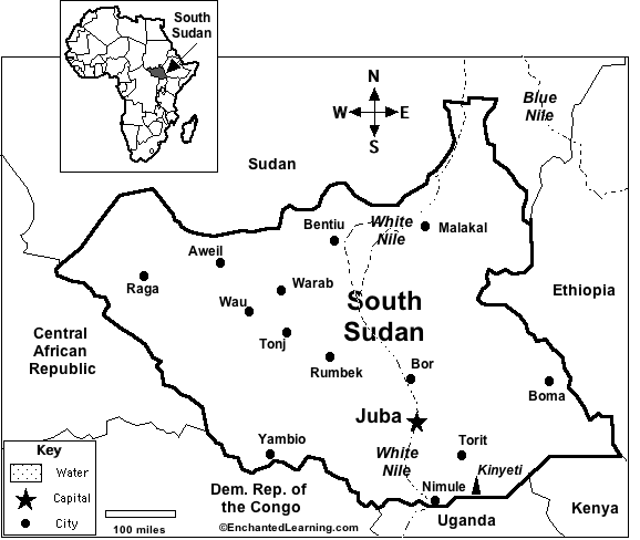 South Sudan Learn basic facts about South Sudan. |
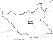 South Sudan An outline map of South Sudan to print. Or go to printable worksheets that require research (using an atlas or other geography reference): a simple map research activity, a medium-level map research activity, or an advanced map research activity. |
 South Sudan: Map Quiz Worksheet A printable quiz on the major geographic features of South Sudan. The student reads a map to answer 10 geography questions, for example: "If you traveled south from Juba, which country would you enter?" Or go to the answers. Or go to a pdf of the quiz and the answers |
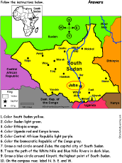 South Sudan: Follow the Instructions Draw and color South Sudan according to simple directions, such as, "Draw a red circle around Juba, the capital city of Sudan." Or go to the answers. |
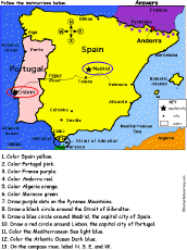 Spain and Portugal: Follow the Instructions Color Spain and Portugal according to simple directions, such as, "Draw a red circle around Lisbon, the capital city of Portugal." Or go to the answers. |
 Spain and Portugal: Map Quiz Worksheet A printable quiz on the major geographic features of Spain and Portugal. The student reads a map to answer 10 geography questions. Or go to the answers. |
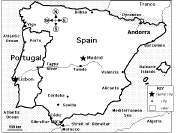
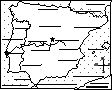 Spain and Portugal Label Me! Printout Label the map of Spain and Portugal. Answers |
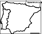 Spain and Portugal: Outline Map Printout An outline map of the Iberian Peninsula to print. |
 Spanish Theme Page Information, quizzes, and printouts. |
 My State: Compass Rose Map In this printable map activity, the student has to think about where things are located with respect to a familiar place. For each direction in the compass rose (N, NE, E, SE, S, SW, W, NW), write something that is located in that direction from your state. |
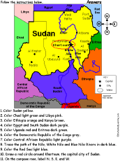 Sudan: Follow the Instructions Draw and color Sudan according to simple directions, such as, "Draw a red circle around Khartoum, the capital city of Sudan." Or go to the answers. |
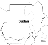 Sudan An outline map of Sudan to print. Or go to printable worksheets that require research (using an atlas or other geography reference): a simple map research activity, a medium-level map research activity, or an advanced map research activity. |
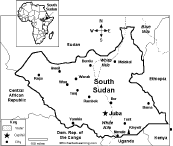
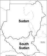 Sudan and South Sudan An outline map of Sudan and South Sudan to print. |
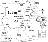 Sudan: Map Quiz Worksheet A printable quiz on the major geographic features of Sudan. The student reads a map to answer 10 geography questions, for example: "If you traveled south from Khartoum, which country would you enter?" Or go to the answers. Or go to a pdf of the quiz and the answers |
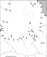 Sudan: Dot to Dot Mystery Map Connect the dots to draw the borders of a mystery country. Then use a globe or atlas to figure out which country you have drawn. You might want to give students clues, such as the continent the country is in (Africa), that it is in the Northern Hemisphere, or that its name starts with an "S." Answer: Sudan. |
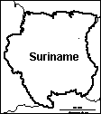 Suriname: Outline Map Printout An outline map of Suriname to print. |
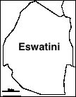 Swaziland (now Eswatini): Outline Map Printout An outline map of Eswatini to print. Or go to printable worksheets that require research (using an atlas or other geography reference): a simple map research activity, a medium-level map research activity, or an advanced map research activity. | 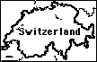 Switzerland: Outline Map Printout An outline map of Switzerland to print. |
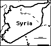 Syria: Outline Map Printout An outline map of Syria to print. Or go to printable activities that require research (using an atlas or other geography reference): a simple map research activity, a medium-level map research activity, or an advanced map research activity. |
| EnchantedLearning.com World Geography |
Flags |
| Africa | Antarctica | Asia | Australia/Oceania | Central America/ Caribbean | Europe | Mideast | North America | South America | USA |
| A | B | C | D | E | F | G | H | I | J | K | L | M | N | O | P | Q | R | S | T | U | V | W | X | Y | Z |
Enchanted Learning®
Over 35,000 Web Pages
Sample Pages for Prospective Subscribers, or click below
|
Overview of Site What's New Enchanted Learning Home Monthly Activity Calendar Books to Print Site Index K-3 Crafts K-3 Themes Little Explorers Picture dictionary PreK/K Activities Rebus Rhymes Stories Writing Cloze Activities Essay Topics Newspaper Writing Activities Parts of Speech Fiction The Test of Time
|
Biology Animal Printouts Biology Label Printouts Biomes Birds Butterflies Dinosaurs Food Chain Human Anatomy Mammals Plants Rainforests Sharks Whales Physical Sciences: K-12 Astronomy The Earth Geology Hurricanes Landforms Oceans Tsunami Volcano |
Languages Dutch French German Italian Japanese (Romaji) Portuguese Spanish Swedish Geography/History Explorers Flags Geography Inventors US History Other Topics Art and Artists Calendars College Finder Crafts Graphic Organizers Label Me! Printouts Math Music Word Wheels |
Click to read our Privacy Policy
| Search the Enchanted Learning website for: |
Copyright ©2002-2018 EnchantedLearning.com ------ How to cite a web page