
|
| Our subscribers' grade-level estimate for this page: 4th - 5th |
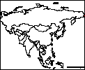 Outline Maps |
EnchantedLearning.com World Geography |
 Flags |
| Africa | Antarctica | Asia | Australia/Oceania | Central America/ Caribbean | Europe | Mideast | North America | South America | USA |
| A | B | C | D | E | F | G | H | I | J | K | L | M | N | O | P | Q | R | S | T | U | V | W | X | Y | Z |
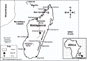
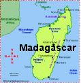 Madagascar An page on the geography, people, and wildlife of Madagascar with an accompanying quiz. |
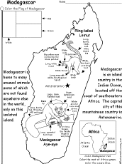 Madagascar: Coloring Printout An easy, printable coloring worksheet about Madagascar with a map of Madagascar, its flag, and labeled pictures of the lemur and aye-aye. |
 Madagascar: Map Quiz Worksheet A printable quiz on the major geographic features of Madagascar. The student reads a map to answer 10 geography questions. Or go to the answers. |
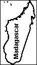 Madagascar: Outline Map Printout An outline map of Madagascar to print. Or go to printable worksheets that require research (using an atlas or other geography reference): a simple map research activity, a medium-level map research activity, or an advanced map research activity. |
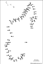 Madagascar: Dot to Dot Mystery Map Connect the dots to draw the borders of a mystery country. Then use a globe or atlas to figure out which country you have drawn. You might want to give students clues, such as the continent the country is in (Africa), that it is in the Southern Hemisphere, or that its name starts with "M." Answer: Madagascar. |
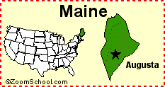 Maine Maine is a state in the northeastern United States of America. Its capital is Augusta. Map, flag, symbols, printouts, and quizzes. |
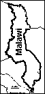 Malawi: Outline Map Printout An outline map of Malawi to print. Or go to printable worksheets that require research (using an atlas or other geography reference): a simple map research activity, a medium-level map research activity, or an advanced map research activity. |
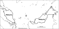 Malaysia: Outline Map Printout An outline map of Malaysia to print. Or go to printable worksheets that require research (using an atlas or other geography reference): a simple map research activity, a medium-level map research activity, or an advanced map research activity. |
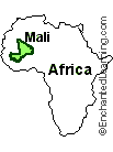 Mali Mali is an inland country in western Africa. Timbuktu is an ancient city in Mali. |
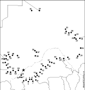 Mali: Dot to Dot Mystery Map Connect the dots to draw the borders of a mystery country. Then use a globe or atlas to figure out which country you have drawn. You might want to give students clues, such as the continent the country is in (Africa), that it is in the Northern Hemisphere, or that its name starts with "M." Answer: Mali. |
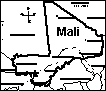 Mali Label a map of Mali. Answers |
 Mali: Outline Map Printout An outline map of Mali to print. Or go to printable worksheets that require research (using an atlas or other geography reference): a simple map research activity, a medium-level map research activity, or an advanced map research activity. |
   map projections There are many ways of making maps. Since a map is a 2-dimensional representation of a curved surface (a globe), the map cannot be perfectly accurate. They are called projections because map-makers have to project a 3-D surface onto a 2-D map. There are many different types of projections that have different uses. Some projections preserve compass directions but distort areas (like Mercator projections), while others preserve area but distort distances and compass directions (like Robinson projections). |
 Map Reading Activity Printout #1 Color the map, read compass directions, estimate distance, and read latitude and longitude. Answers |
 Map Reading Activity Printout: Topographic Maps #1 Color the elevations of the topographic map, then answer questions about the map. Answers |
 Map Reading Activity Printout: Topographic Maps #2 Color the elevations of the topographic map, interpret the map and answer questions. Answers |
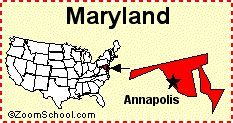 Maryland Maryland is a state in the northeastern United States of America. Its capital is Annapolis. Map, flag, symbols, printouts, and quizzes. |
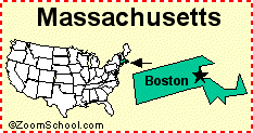 Massachusetts Massachusetts is a state in the northeastern United States of America. Its capital is Boston. In 1620, the Pilgrims landed in what is now Massachusetts. Map, flag, symbols, printouts, and quizzes. |
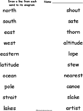 Match the Geography Anagrams Draw a line from each geography-related word to its anagram. Words: north/thorn, south/shout, east/sate, west/stew, eastern/nearest, latitude/altitude, ocean/canoe, pole/lope, strait/artist, lakes/slake. Or go to the answers. |
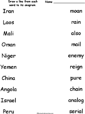 Match the Country Name Anagrams Draw a line from each country name to its anagram. Words: Iran/rain, Laos/also, Mali/mail, Oman/moan, Niger/reign, Yemen/enemy, China/chain, Angola/analog, Israel/serial, Peru/pure. Or go to the answers. |
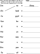 Match the Syllables: Country Names Match the syllables to make 10 country words. The words are China, Ireland, Egypt, Cuba, Haiti, Kenya, Norway, Peru, Japan, Brazil. Or go to the answers. |
 Mauritania: Outline Map Printout An outline map of Mauritania to print. Or go to printable worksheets that require research (using an atlas or other geography reference): a simple map research activity, a medium-level map research activity, or an advanced map research activity. |
 Mauritius: Outline Map Printout An outline map of Mauritius to print. |
 Mediterranean Outline Map Printout An outline map of the Mediterranean Sea to print. |
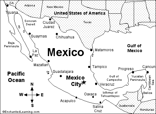
 Mexico, Geography Information on the geography of Mexico. |
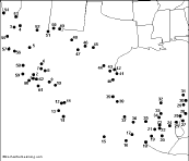 Mexico: Dot to Dot Mystery Map Connect the dots to draw the borders of a mystery country. Then use a globe or atlas to figure out which country you have drawn. You might want to give students clues, such as the continent the country is in (North America), that it is in the Northern Hemisphere, or that its name starts with "M." Answer: Mexico. |
 Mexico: Map Quiz Worksheet A printable quiz on the major geographic features of Mexico. The student reads a map to answer 10 geography questions. Or go to the answers. |
 Mexico Map: Label Me! Printout Label a map of Mexico. Answers |
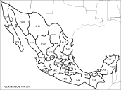 Mexican States Map: Label Me! Printout Label the states of Mexico. Answers |
 Mexico: Outline Map Printout An outline map of Mexico to print. Or go to printable worksheets that require research (using an atlas or other geography reference): a simple map research activity, a medium-level map research activity, or an advanced map research activity. |
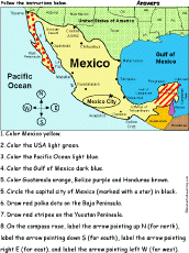 Mexico: Follow the Instructions Color Mexico according to simple directions, such as, "Color Mexico yellow." Or go to the answers. |
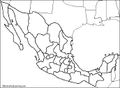 Mexican States: Outline Map Printout An outline map of the states of Mexico to print. |
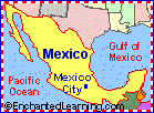 Mexico: Zoom School Use a pictorial interface to get Information on Mexico, incuding maps, flag, animals, explorers, fossils, a quiz, and printouts on Mexico. Mexico is a Spanish-speaking country in North America. Its capital is Mexico City. |
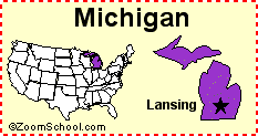 Michigan Michigan is a state in the northern United States of America. Its capital is Lansing. Map, flag, symbols, printouts, and quizzes. |
 Middle East Geography Pages on the geography of the Mideast. |
 Middle East Map: Label Me! Printout Label a map of the Middle East. Answers |
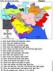 Middle East: Follow the Instructions Color the mideast according to simple directions, such as, "Circle both Bahrain and Cyprus in red." Or go to the answers. |
 Middle East: Outline Map Printout An outline map of the Middle East to print. |
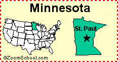 Minnesota Minnesota is a state in the United States of America. Its capital is St. Paul. Map, flag, symbols, printouts, and quizzes. |
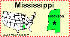 Mississippi Mississippi is a state in the United States of America. Its capital is Jackson. Map, flag, symbols, printouts, and quizzes. |
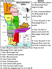 Mississippi River States: Follow the Instructions Color states on a map of the Mississippi River States in the USA according to the directions, such as, "Color Minnesota (where the Mississippi River begins) orange." The states are labeled with their abbreviations. States: Texas, Georgia, Florida, California, Virginia, Washington, Illinois, Ohio, New York, Pennsylvania, Michigan, Oregon, Colorado, Nebraska, Montana, Utah, Missouri, Alabama. Or go to the answers. |
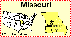 Missouri Missouri is a midwestern state in the United States of America. Its capital is Jefferson City. Map, flag, symbols, printouts, and quizzes. |
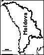 Moldova: Outline Map Printout An outline map of Moldova to print. |
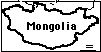 Mongolia: Outline Map Printout An outline map of Mongolia to print. |
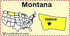 Montana Montana is a state in the United States of America. Its capital is Helena. Map, flag, symbols, printouts, and quizzes. |
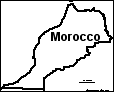 Morocco An outline map of Morocco to print. Or go to printable activities that require research (using an atlas or other geography reference): a simple map research activity, a medium-level map research activity, or an advanced map research activity. |
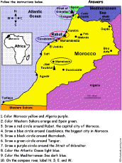 Morocco: Follow the Instructions Draw and color Morocco according to simple directions, such as, "Draw a blue circle around Casablanca, the biggest city in Morocco." Or go to the answers. |
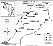 Morocco: Map Quiz Worksheet A printable quiz on the major geographic features of Morocco. The student reads a map to answer 10 geography questions. Or go to the answers. |
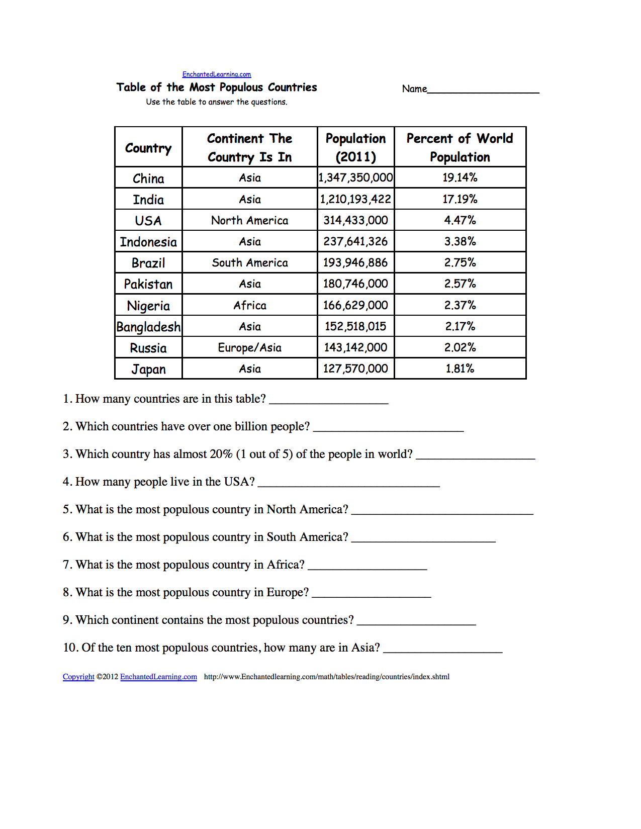 Most Populous Countries: Reading and Understanding Tables Use the table to answer the questions about the most populous countries in the world. Or go to the answers. Or go to a pdf of the quiz and the answers (site members only). |
 Most Populous US States: Reading and Understanding Tables Use the table to answer the questions about the biggest US states. Or go to the answers. Or go to a pdf of the quiz and the answers (site members only). |
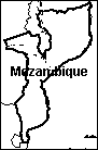 Mozambique An outline map of Mozambique to print. Or go to printable worksheets that require research (using an atlas or other geography reference): a simple map research activity, a medium-level map research activity, or an advanced map research activity. |
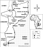 Mozambique: Map Quiz Worksheet A printable quiz on the major geographic features of Mozambique. The student reads a map to answer 10 geography questions. Or go to the answers. |
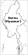 Myanmar/Burma: Outline Map Printout An outline map of Burma/Myanmar to print. |
| EnchantedLearning.com World Geography |
Flags |
| Africa | Antarctica | Asia | Australia/Oceania | Central America/ Caribbean | Europe | Mideast | North America | South America | USA |
| A | B | C | D | E | F | G | H | I | J | K | L | M | N | O | P | Q | R | S | T | U | V | W | X | Y | Z |
Enchanted Learning®
Over 35,000 Web Pages
Sample Pages for Prospective Subscribers, or click below
|
Overview of Site What's New Enchanted Learning Home Monthly Activity Calendar Books to Print Site Index K-3 Crafts K-3 Themes Little Explorers Picture dictionary PreK/K Activities Rebus Rhymes Stories Writing Cloze Activities Essay Topics Newspaper Writing Activities Parts of Speech Fiction The Test of Time
|
Biology Animal Printouts Biology Label Printouts Biomes Birds Butterflies Dinosaurs Food Chain Human Anatomy Mammals Plants Rainforests Sharks Whales Physical Sciences: K-12 Astronomy The Earth Geology Hurricanes Landforms Oceans Tsunami Volcano |
Languages Dutch French German Italian Japanese (Romaji) Portuguese Spanish Swedish Geography/History Explorers Flags Geography Inventors US History Other Topics Art and Artists Calendars College Finder Crafts Graphic Organizers Label Me! Printouts Math Music Word Wheels |
Click to read our Privacy Policy
| Search the Enchanted Learning website for: |
Copyright ©2002-2018 EnchantedLearning.com ------ How to cite a web page